New Zealand, South Island
24th March to 14th April 2005
The following is based on the notes I took during the trip, but may have been edited in order to leave out boring bits or protect the innocent.
For photos-only version go here.
|
|
New Zealand, South Island24th March to 14th April 2005 |
|
The following is based on the notes I took during the trip, but may have been edited in order to leave out boring bits or protect the innocent. For photos-only version go here. |
|
|
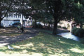
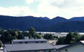
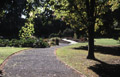
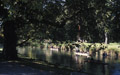
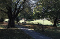
Arrived in Christchurch! Flight was good, and my airmiles up-grade had come through for the main flight from San Francisco to Sydney. (The best part about travelling business class was that I was able to have a shower at the airline lounge in Sydney, and consequently arrived in Christchurch feeling quite human.) When I arrived, customs wanted to examine my tent and bike, but this didn't turn out to be a big deal. Andrew Errington was waiting on the other side of customs, and took me to Foley Towers, the hostel at which I was staying. The hostel was nice, and had very nice gardens, though it did make me feel a little old since most of the people there were about half my age. It probably didn't help that there was an REM concert next day, and many of the people were there for that. I didn't have cell-phone coverage at the airport so I called Sara when I got to the hostel. Decided to get on with assembling the bike while I was still awake - it went smoothly enough. Then went for a short walk along the river and found a cafe/bar for dinner. Went to bed early and slept well. |
|
|
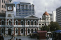
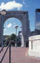
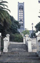
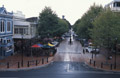
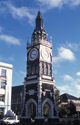
Walked downtown in the morning, and acquired AA maps, a SIM card for the phone and NZ dollars. Kiwis are amazingly helpful people. Started a walking tour from the leaflet I'd picked up at the hostel, starting at Cathedral Square.Then walked to a Thai restaurant on Manchester Street where I met Andrew and Georgina (called George) for lunch. Headed back to Foley Towers and switched to bike gear to take a short ride to make sure everything was working. First went to a bike store to get spare tubes and borrow a pump. The guys there spent a while examining my bike and racks, and I promised to come back so they could check out the Beckman panniers also. I tried to follow the Christchurch Parks and Gardens route from the Lonely Planet guide. Rode through N. Hagley Park, Mona Vale, and University of Canterbury campus. Only about 16km total (fortunately, switching the computer from miles to km makes it seem like you're going further and faster). In the evening went to Andrew and George's for a very good dinner. |
|
|
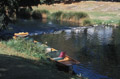
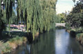
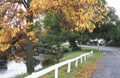
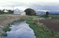
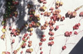
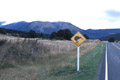
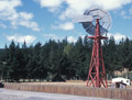
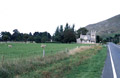
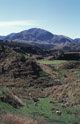
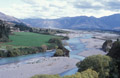
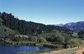
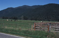
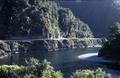
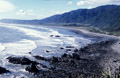
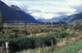
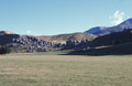
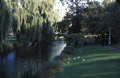
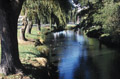
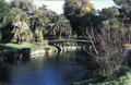
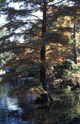
Raining early in the morning, so ended up sleeping till 9. I loaded up my bike with panniers and gear to try a longer ride. However it started raining harder so I decided to wait it out. I left at about midday, while there was still a slight drizzle. I followed route out along the Avon towards New Brighton. The stretch along the Avon, heading out from Christchurch, was very scenic, and I stopped to take some photos of a tree in autumn colours and of some rowers even though the light was dull. New Brighton was pretty dreary (much like the original Brighton) though it might have been a bit nicer with the sun out (again, much like the original Brighton). Still I walked up to the beach to show good faith. The sun came out for a while on the return journey. The route went along the coast for a while and then turned inland and started climbing. This started with a very tough, 5.5 km climb up Mt. Pleasant Road where I really felt the extra load. The pay off was the spectacular views along Summit Road, which was long and rolling towards Dyers Pass. At Dyers Pass I stopped at The Sign of the Kiwi for coffee and scones and to look at the views. Also bought some cookies there to replace Cliff Bars as riding food. From Dyers Pass there was a wonderful descent into a long flat road into Christchurch: the descent was windy but not knuckle-whiteningly steep, and also perfectly paved. About 46km total ride. In the evening Andrew picked me up and we got fish and chips on the way back to eat with him and Georgina. I also left my suitcase and bike case with them, and my tent and other excess stuff that I thought I could ask them to send on if it turned out I needed them. |
|
|
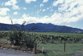
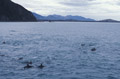
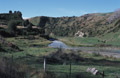
Packed up at Foley Towers and waited for a bus up to Blenheim at 7am. The stretch of the bus jouney along the coast up to Kaikoura was spectacular, with the ocean on one side and mountains on the other. We stopped in Kaikoura for a coffee break, and also saw some dolphins swimming at Ocean View. I decided I might want to ride that stretch later if I got the chance. After Kaikoura the road went inland, through rolling hills and farmland (sheep, deer, vines, etc.). But it was narrow and heavily trafficked, and I thought it wouldn't be that good to ride. Blenheim didn't look very interesting, and I stopped only long enough to gat a map and directions from the information center before heading out. I went North to Spring Creek and then West on Rapaura Road. Stopped to help a woman with a puncture before Spring Creek, and stopped at Spring Creek to phone Sara and buy some fruit. Continued on Rapaura Road, stopping at Scott Allen and Cloudy Bay vineyards. Cloudy Bay was nicer and also didn't charge for tastings. I also stopped at Mud House and bought some earrings for Sara (but didn't try any wines), and at Clifford Bay where I was going to try the cafe, which was closed, and ended up trying an excellent chardonnay instead. Then rode in to Renwick to Watson's Way Backpackers. Total 26.4 very flat km. There wasn't much choice of places to eat in Renwick, so I ended up having fish-and-chips again. The beer was good, though. |
|
|
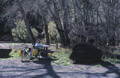
The room at Renwick was noisy in the morning so I couldn't really sleep late. However there was toast and home-made jams for breakfast, which was definitely a plus. This was my first long stage so I was a bit nervous about how my legs would hold up. For the most part the road from Renwick to St. Arnaud was a bit monotonous really - very long and straight, but with a slight, persistant uphill so that I couldn't average more than about 20km/h. Still I found a few interesting places to stop and take photos along the way. There was a hill at about 60km, after which the road got more interesting. I stopped at Kowhai Point, at about 70km, where there were some picnic tables near the river, to eat lunch. I also discovered that 100% DEET insect repellent has absolutely no effect on sand flies. The last 15km or so were hilly and hard. There was a long descent into St. Arnaud which, unfortunately, I was going to have to re-climb the next morning. Total ride 100km and 810m ascent. I stayed at Yellowhouse in St. Arnaud and went to dinner at Alpine Lodge down the road (expensive but not bad). |
|
|
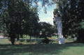
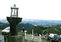
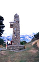
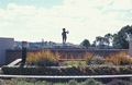
For the first time in the morning I had good weather setting off, and it remained nice for the whole ride to Nelson. What's more, I had a tail wind pushing me up the first hill - things were definitely looking up. The first half of the ride was moderately hilly, with some very nice descents. A lot of the road was along the edge of a valley, so I had a valley full of trees to my left and a ridge to my right. Stopped at Belgrove, where route joined the Hwy 6, for lunch. Second half of the route was mostly flat or downhill and fast, though I had to climb a few hills coming into Nelson. I also stopped a few miles before Nelson to look at the memorial at Rutherford's birthplace. Total 89km and 520m ascent. I stayed at the Paradisio hostel which was impressive, with a swimming pool and showers associated with each room. However, they only had one telephone, which was situated in a noisy place, had a long wait to use it, and wasn't very good. There was also the option of having a dinner cooked at the hostel each night, which was cheap and good. |
|
|
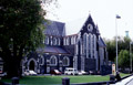
Decided to take a rest day in Nelson since it seemed a nice place to explore. I had a late morning and got up just in time for breakfast. Then walked into downtown Nelson to try out local cafes. Bought coffee, a kakapo for Sara and a Pedallers' Paradise book, cashed some travellers' checks and so on. Walked up to the cathedral which I rather liked, and wandered in its grounds for a while. Stopped at an internet cafe to wait out some rain, and had falafel for lunch. Returned to the hostel and spent a while in the "spa" (Kiwi for hottub). Then spent a while checking some details in the Lonely Planet guide book, before packaging it up with my other souvenirs to be sent back to Andrew in Christchurch. Had dinner at the hostel again - this time chilli with fresh-baked bread (the first really good bread I'd had since being here). Lubed chain and tighted S&S couplings and cranks on bicycle. |
|
|
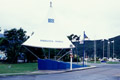
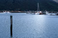
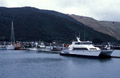
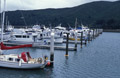
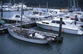
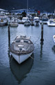
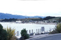
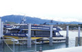
Started off raining hard in Nelson, so I decided to wait till it had subsided a bit - so much for the sunniest place in NZ. Dropped off package at the post office and went on my way in a light drizzle. The first 10km were flat along the shore, and then the road turned inland towards a gully. The first climb should have been easy but the wind picked up, adding to the climb. On the other side the wind got even stronger, and became gusty, and seemed to be blowing me back up the hill. The wind carried on for the next several km, and I had to stop frequently and wait for it to die down for fear of being blown of the road or into the path of a passing logging truck. This made the going very slow. A truck pulling a horse box passed me and saw me stop for the wind. He went a little further to where the road widened, and the driver got out and signalled me to load my bike. We loaded it into the horse box and he gave me a lift. (Fortunately there were no horses and not too much horse shit.) Even the truck seemed to be struggling against the wind. He took me as far as Pelorus Bridge and I rode the last stretch to Haverlock - there was still a headwind and rain, but it was pretty easy going. Only 36.8 km, which made it a very short day for riding. I stayed at the Blue Moon hostel in Haverlock, which was small and friendly and run by a couple out of their house. After having some coffee and lunch and a shower to warm up, I took a short walk to explore Haverlock and the marina. The marina would have been very pretty in the sunshine, and wasn't bad even in the gloom. Later, at dusk, I went for a short walk to look for glow-worms in the caves above Haverlock. The host, who usually lead glow-worm walks in the evenings, decided not to cancel because of the weather. But I went with a Swiss woman named Regina who was staying at the hostel too. I managed to slip and get rather muddy on the way, but the glow-worms were very cool to see, and looked like many constellations of tiny stars. Afterwards we went to have green-lipped mussels and some local wine for dinner, which was excellent. |
|
|
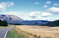
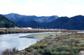
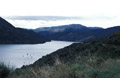
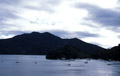
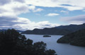
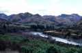
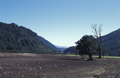
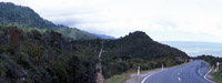
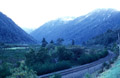
By the time I got going the sun was out and it was pleasant, though there were still plenty of clouds around. Just outside of Haverlock I turned onto Queen Charlotte Drive towards Picton. This was a wonderful bicycling road, with not-too-hard climbs, windy, not-too-steep descents, and magnificent views of the bay and Marlborough Sounds. I got into Picton as the ferry was pulling in and decided not to stop in order to avoid the ferry traffic. The wind picked up again on the way from Picton to Blenheim. I stopped for a short break at Koromiko and for lunch at a bakery in Blenheim. About 10km after Blenheim, a long, hard climb to Dashwood Pass began, and I had to use my lowest gears. The countryside reminded me of Sonoma County in late summer - mostly dry and brown, and barren other than a few cows munching. After Seddon the headwinds really picked up and it became difficult to make progress even on the downhills. I ended up getting into Ward around dusk, and to the bicyclists' hostel, 9km south, well after dark. Total 120km and 1215m of climbing. The bicyclists' hostel was strange but nice in a basic way. The accomodation was in a lodge quite far from the main house, and the whole thing was well off from the main road on gravel roads which were difficult to navigate with just an LED bike light. I bought some eggs from the owners and made myself an omelet, which I had with bread and cheese for dinner. |
|
|
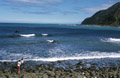
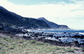
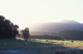
Slept very well after the previous hard day, and, in the morning, realized what a nice situation the lodge was actually in. Stopped at the main house before leaving to check out their wool cycling jerseys, and ended up buying two. I was a bit surprised and disappointed that the owners actually had no interest in bicycling or bicycle touring, and, I suspect, were using the bicyclist bit to avoid making the lodge up to the standard of most of the backpacker lodges. Still it was comfortable and nice to have it all to myself. Got on my way and stopped at the cafe at Kakerengu for breakfast, which was really good, and also nicely situated with a view of the sea. The road to Kaikoura followed along the coast, so I had the ocean to my left and hills to my right most of the way. There were some moderate headwinds and rolling hills up to Kakerengu, after which the winds died down, the road flattened out, the sun came out, and everything seemed perfect. I met a bicycle tourer going the other way and we stopped to chat. He turned out to be from Holland and had been riding around NZ for five months. (I felt slightly jealous.) I stopped at a lookout point at about 50km to eat lunch. A bit later I passed a rocky section of coast where there were many seals lying around in the sun, presumably working on their tans. The last stretch before Kaikoura went inland and wound a bit. Total 77km and 390m climbing. I reserved a room at a backpacker hostel called Dusky Lodge, about 10 minutes walk from the center of Kaikoura, mostly because they had a spa and swimming pool. When I got there I started to catch up on laundry, since my clothes were still muddy from the glow-worm trek. Once I had some clean clothes to wear, I headed in to town, and found a restaurant where I could get crayfish for dinner. (The name Kaikoura actually translates to "eat crayfish" so it seemed best to follow directions.) |
|
|
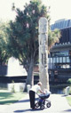
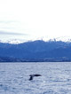
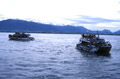
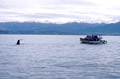
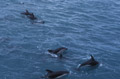
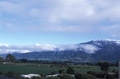
Got up quite early. Made coffee, spoke to receptionist about whale watching and phoned Sara. There was snow on the mountains to the northwest which seemed surprising. I went to the bakery next door to get breakfast, and decided that they had many interesting baked goods and I should go back to stock up before the next day's ride. I went on the 10am whale watching trip, which worked out well since I later heard that the afternoon trips had been cancelled due to weather. The Whale Watchers cruise was an impressively high-tech affair, with high-speed catemerans, various state-of-the-art whale-finding equipment and computer animation. We were lucky with the cruise - we saw four sperm whales (three different ones, and returned to the place where the first one had dived to see it again when it resurfaced); two albatrosses - one in flight and one sitting on the water; and a group of well over a hundred dusky dolphins (which was considered a "small" group) at the end. We spent about 15 minutes with the dolphins swimming around the boat, jumping and playing, before they all decided to swim away in unison, which was a fabulous sight. The dolphins definitely were the highlight - for the sperm whales there wasn't really that much to see, except for a little island of whale and the occasional water spout, until they decided to dive when you get to watch them do a little "pre"-dive and then the tail comes out of the water and down they go. After the whale-watching trip, I went into the town to look at shops and get lunch. I found a box that I thought would make a good present for my cat-sitting friends, and also looked at a knife from a local maker and debated getting it for myself. I went back to the hostel to package things up to send to Andrew (box, excess clothes, etc.), and then returned to town to post it. Had another look at the knife and decided I'd better buy it and add it to the package. I decided I should start a list of things that I should have bought on the trip and didn't, for future reference. So far the list would be: Also I should have left behind the DEET insect repellent and got something locally made instead, and minimized the off-bike clothes, since they didn't get that sweaty. And I shouldn't have bothered with the cell-phone since there's no coverage outside the major cities and, even with a pre-paid SIM card, it's very expensive to use. |
|
|
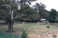
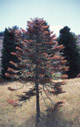
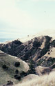
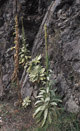
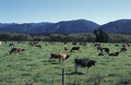
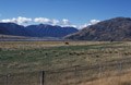
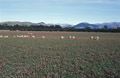
I stocked up at the bakery next to the hostel before heading on my way. About 5km South of Kaikoura I turned onto the inland road. The road mostly went through farmland - primarily sheep and cattle. I passed a pen with many sheep standing shoulder-to-shoulder and, a little way off, a dog lying down watching them and looking pleased with himself. I also passed some brown-and-white cows in a field with calves who looked very cute. The road was hilly, though not too many very steep parts - I spent a lot of time in my lowest middle gear, but only a little bit in the granny gear. As the road gained altitude the scenery became more stark and impressive. I passed another field in which a group of cows seemed to want to run alongside the bicycle. I stopped to take various photos, including some weird Kiwi plants, hoping to identify them later. On one of the descents I got a fright when a wasp flew into my helmet and was buzzing right next to my ear. Fortunately I was able to stop, remove my helmet and kill it without it getting me, which saved the use of an Epipen and a much shorter day. I stopped for lunch at a picnic area about 10km short of Waiau. The last stretch before Waiau and from Waiau to Culverden was very flat and I managed to make good time inspite of my legs being tired. The road was very quiet, with few settlements and very little traffic (and no trucks!) all day, which gave the day a peaceful sense of solitude and made it a good thinking day. Before the trip I'd been apprehensive about this part of travelling alone, but it seemed very enjoyable. Mind you, it helped to know that there are people at home thinking of me to return to, and I still enjoyed meeting fellow travellers in the evenings. Overall it was a tough day with 108km and 1340m (!) of climbing. I stayed at the motel in Culverden. It seemed very luxurious to have a whole motel room to myself, with lounge, bedroom and kitchenette. Unfortunately there was no phone in the room and the only payphone in the town wouldn't let me use my phone card or recognize my credit cards. Also the only restaurant was already planning to close when I got there at 6pm. So I ordered right away and then borrowed their phone to make a quick call to Sara while I was waiting. |
|
|
The winds were back. I set off about 9am, stopping at the store in Culverdon to buy some fruit on the way. The shopkeeper warned me about strong winds when I said that I was planning on riding over Lewis Pass that day. As I started off the winds picked up and also became quite gusty. On top of which my legs felt more tired than I expected, and I started to wonder whether to take a detour and leave Lewis Pass for another day. The road was quite straight with a gentle gradient, but, even so, the headwind made the going very slow. By the turn off for Hanmer Springs the wind had not died down, and, if anything, seemed to be getting stronger, so I took the turn and headed towards Hanmer Springs. I stopped at the information center to ask if they knew the weather forecast, and they said that very strong winds or gale-force winds were likely for the rest of the day, so I booked into the Hanmer Backpackers down the street. (Total only 39km and 385m climbing.) Once settled in at the hostel, I went for a walk into the town. It was still extremely windy, with signs being blown over and the trees moving. The wind was also very hot. According to an email I got from Andrew, this was what people refered to as a "Nor'wester". I had some lunch, checked email, and then went to the thermal pools for a bit. I thought of another item for the list of things I should have brought: I decided to be a bit extravagant and went for a very good dinner at a restaurant called "The Old Posthouse". |
|
|
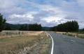
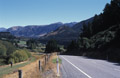
I woke up to a very nice sunny day and felt psyched for a second attempt at Lewis Pass. I stopped at a bakery to get some fresh-baked rolls for lunch before heading out. The first 10km or so was backtracking the route to Hanmer Springs to get back to the main road to Lewis Pass. Once back on the main route, the first 40-50km were mostly rolling hills, some of them quite steep. The winds picked up, going southwest as predicted, and became quite strong as the day wore on, making the going tough. The scenery was mostly scrub and grassland, with almost dry river beds and mountains all around. There were some cattle, but not many. Starting about 15km before the top of the pass, there were trees closing in along the edge of the road, which shielded me from the wind. The trees turned into a forest, which reminded me of what I'd imagined Lórien to be like: tall, slender trees and many saplings, with the sunlight filtering through the higher branches and playing off the sapling's leaves. (I've no idea if this was anywhere near any of the parts they used to make the film.) For a while the road also ran alongside a small, rocky stream with the sun shining on the waters. As the road got closer to the pass the climbing got more consistent, and the last few km were pretty steep. Oddly there was no marking for the top of the pass that I could see. The descent, for the first few km after the top, through the forest, was most enjoyable. I stopped at Marrui Springs resort to eat a very late lunch. After Marrui Springs, the descent became more gentle until Springs Junction. Total 95km and 1240m climbing. When I got to the motel at Springs Junction they first said that there were no rooms left, but, after looking pathetic, they said they did have one room but the fridge wasn't working, which was fine with me. |
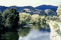
|
|
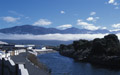
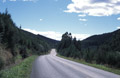
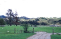
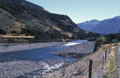
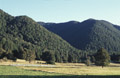
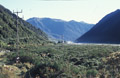
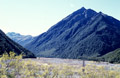
I woke up to a cold and foggy morning, and actually had to wear long-fingered gloves for the first time. The climb to Rahu Saddle started almost at once. It wasn't too steep, but I was glad I hadn't tried it the day before. It was followed by a long downhill, and then the road flattened out towards Reefton. Most of the way to Reefton was through forests, though it opened out to plains in the last 10km. The forests took on a mysterious look in the early morning fog, but the fog burned off by 10am, leaving blue skies and a more "Sherwoody" feel to the forest. Reefton was a nice little town, nestled amongst the tree-covered hills. I stopped there for lunch and to buy some food. From Reefton to Inangahua Junction the road was mostly flat and straight and fairly easy going. The scenary was mostly flat grassland, with some cattle and tree-covered hills a little way off on either side. It was also very green and lush - much more so than the east coast. After Inangahua Junction the road started to wind a bit more and go over some gently rolling hills, and the hills on either side started to close in on the road. After a while the plains on the right opened out again for a while, and then closed in again. The road started to follow a gorge, with steep sides and sometimes overhanging cliffs to the left, and the Buller River to the right. Eventually the river widened and slowed down, and the gorge became less deep. Then the road went its own way for the last few km into Westport. Total 125km and 645m of climbing, which made it another long day. Stayed at the Trip Inn hostel in Westport, which was fine but nothing special. Overall Westport didn't seem like a terribly exciting place to stay. |
|
|
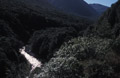
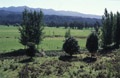
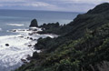
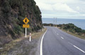
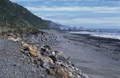
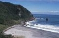
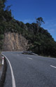
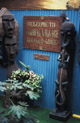
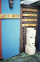
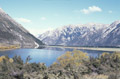
I tried to get an early start. My legs were feeling tired but Westport didn't seem like a good place for a rest day and bad weather was predicted for Friday, so I decided to aim for Greymouth and take it easy. After retracing my steps for the first 6km, I joined the main highway to Greymouth. The road started off relatively flat, with some rolling hills, going through mostly scrubland and grassland, with the omnipresent mountains looming to the right. The colour scheme seemed very green for this part of the island. After a while the hills got steeper and longer and I continued climbing overall until the descent at the start of Paparoa park. The descent to the coast was truly spectacular, and required me to make several photo stops. The coast was rocky and dramatic, and the tree-covered hills and cliffs seemed to rise straight out of the sea. The road was cut into the side of the hills, or, alternately, the cliffs, following the shoreline. (Note: coastal roads can be very hilly too.) The dramatic coastline, cliffs, and hilly road continued all the way to Punakaiki, where I stopped for lunch. After Punakaiki, the road flattened out for a while, with wide green fields between it and the sea, and the hills continuing on the right. Then the plains vanished and the cliffs rising out of the sea (and the hilly road) returned until shortly before Greymouth. Total 103km and approximately 1000m of climbing. In Greymouth I stayed at the Global Village backpackers which was easily the nicest place I'd stayed so far. There were African statues, masks and art all over, batiks and paintings on the walls, murals and ethnic designs painted on the walls, and so on. On top of that, there was a real fire in the lounge, fresh farm eggs for sale at the reception, and, what's more, the owner/manager made chocolate muffins in the evening and went around offering them to everyone. I bought some fresh eggs and made myself an omelette for dinner. |
|
|
Got up late and found it was raining, so I'd picked the right day for a rest day. The more time I spent in the Global Village hostel the more I liked it. It had a great feel to it, as well as being very cool to look at, and had great people running it. It was clear that it was being run as a labour of love and not just a business. The rain lightened up a bit, so I decided to go for a walk into town. I stopped at a cafe for lunch, and looked at the jade gallery, but didn't buy anything. Overall Greymouth seemed like a nice town, and I would have liked to have done some of the local walks if the weather had been better. I did go on a short loop walk from Anzak Park, next to the lakes. Spent the rest of the day at Global Village, doing laundry, checking email, starting a new bracelet, and generally relaxing. For dinner I went to an Indian restaurant recommended by my host which was pretty good, although I did get rather wet on the way back. |
|
|
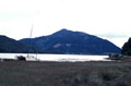
When I got up it looked like a nice day, but by the time I was having breakfast it was raining again. Dawdled a bit before leaving to see if the rain would stop, and also because I felt a little bit sad about leaving the hostel. I left at about 10am, with the rain slowed to a drizzle and blue skies up ahead to encourage me. The rain stopped soon after, and the sun came out. The road from Greymouth was flat and easy-going, passing through some small towns or villages and then farmland. At Kumara junction I turned inland, towards the mountains, and the road continued flat with a slight incline. Kumara itself didn't look that interesting and I didn't stop. After Kumara the scenery opened out, providing a good view of the mountains. A bit further on there was a long stretch of gravel and unpaved road, and I was grateful for my cross tires. As the mountains got closer they became increasingly intimidating. From a distance, because the sides were covered with trees, they looked like big grassy hills, but this was definitely giving a false sense of security. As the road climbed further it got steeper and hillier, and the weather got cooler. I stopped at a picnic area at 55km for lunch and was attacked by marauding sandflies. As I was leaving the sky was turning grey, and shortly after it started to rain. I took shelter at a tavern at Jacksons, in order to change into a warmer jersey and rain gear, and decided to stay for a hot chocolate by the fire. When I left the rain had stopped, and the sun even came out for a short while, which felt good. The remaining 20km were uneventful: the road got steeper and windier and climbed a little more. The mountains were on either side of the road now, as if stalking and getting ready to pounce. But I turned off the road at Otira, so, in my case, they'd have to wait another day. Total 83km and 725m ascent. I stayed at Rata Lodge backpackers in Otira, which was nice but basic, and run by a very friendly couple. |
|
|
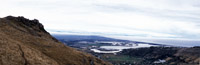
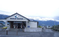
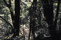
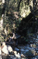
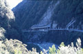
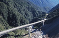
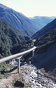
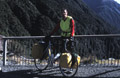
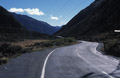
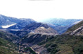
When I awoke it seemed like a nice day, but there was frost on the ground and it felt cold. It was hard to get out of bed (I'd slept in my sleeping bag under the provided duvet). The first couple of km from Otira were gently uphill, giving me a little bit of an opportunity to warm up. Then the road started winding and becoming steeper. After a couple more km and a handful of one-lane bridges, it became very steep indeed. By this time the mountains on either side had closed in completely, and the road was running alongside a rocky and fast-moving stream between two steep, tree-covered banks. For some short sections I found it quicker and easier to walk the bike uphill. Fortunately there was always the excuse of fabulous scenery waiting to be photographed whenever I wanted to stop. Another item for my list of things I should have brought: Eventually the road reached a (very steep) viaduct. It seemed misleading since the viaduct looked flatter and easier than the road, but, once on it, I could hardly move. After the viaduct I stopped at the viewpoint at the quaintly named "Death's Corner" and asked someone to photograph me with the bike. After Death's Corner, there was one more very steep section, and then the road flattened out before the summit. I was very glad to finally get to the descent to Arthur's Pass Village, where I stopped to get some lunch and stock up on bananas. After Arthur's Pass Village, the road went through a series of rolling hills, tending downwards, and then levelled out and continued rolling, averaging about 600m altitude. The area opened out into flat plains with the mountains still surrounding but, now that I was on the East side of the island, the grass lands looked much more brown and the mountains bare and rocky. A very steep climb lead in to a hilly section leading to Porter's Pass (could have used a 24 tooth chainring again). The section of hills to Porter's Pass wasn't as strenuous as Otira Gorge, but still very hard and would have made it a tough day just by itself. At 940m it was actually slightly higher than Arthur's Pass. After Porter's Pass there was a very steep descent for several km, but I was a bit too tired to really appreciate it. This was followed by a more gentle downhill all the way to Springfield which allowed me to make good time for the last section and get into Springfield not as late as I'd feared. I arrived about dusk. 96km and 1535m ascent - a very tough day. I stayed at the Springfield Hotel, which seemed to be a combined "hotel", backpackers lodge, bar and restaurant. It was a bit grotty and moth-eaten, but warm and had hot, powerful showers. I went looking for Mo's Bar, hoping to get a Flaming Mo, but couldn't find it. |
|
|
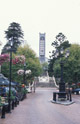
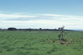
I made an early start from Springfield since it didn't seem an especially appealing place to hang around. Stopped for breakfast at a bakery in Darfield. The road from Springfield was very flat and straight, running through the Canterbury Plains. The countryside around was also flat, with the mountains slowly disapearing behind me as I rode. Overall the scenery was rather more dull and less inspiring than the scenery I'd been riding through the last few days, unless, of course, you are inspired by sheep. Got into the outskirts of Christchurch a little after mid-day, and stopped at a payphone to call some backpackers and reserve a room. Ended up getting a place at Dorset House which was on the northeast corner of Hagley Park, and seemed a nice location. I also stopped by the touring bike shop to show off my panniers as I'd promised. After checking in at Dorset House, I took a walk around Christchurch. I bought another postcard, though it wouldn't arrive until after I got back, and a copy of The Bone People, since it seemed an appropriate thing to read on the plane. I returned to the hostel and Andrew and George picked me up to go out for dinner later. I ate lamb shanks since I hadn't really eaten lamb this trip, except for in Indian food and pies. I also retrieved my bags, packages and other excess stuff from Andrew and George. |
|
|
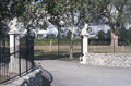
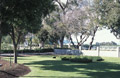
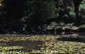
I got up pretty late. Booked a trip to Akaroa for the next day, and a taxi to the airport at 5:15am the following morning. Then went looking for a post office and payphone to phone home. I set out on a walk in Hagley Park, along the river, and to the botanical gardens. I was particularly interested in the NZ and NZ Alpine gardens since I hoped to identify some of the weird plants I'd been seeing, but also liked the flowering rock gardens a lot. I walked along the side of the river for a while, and then into the town center. I found a car shop that Andrew had pointed out as being the local Morgan dealer (also TVR and a few others). They had many nice older cars, including a beautifully restored Morgan Series 1 4/4. Also a couple of XK120s and a Maserati Ghilbi, and a huge selection of models, badges and such like. I bought a very tiny model Plus 8 and considered a larger Plus 8 kit but decided it was too expensive. I had lunch at one of the restaurants on "the strip", and went back to the hostel in order to pack the bike and do laundry. Eventually I managed to disassemble and pack the bike, actually a bit better than last time. I also noticed that one of the off-side spokes on the rear wheel had broken - I don't know when it had happened, but the wheel seemed to have held its true. Met Andrew and George later and went to a Japanese restaurant. Discovered that Kiwi Japanese food is quite different from American Japanese food. |
|
|
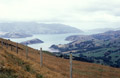
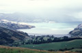
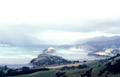
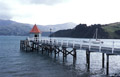
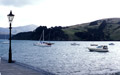
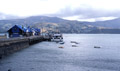
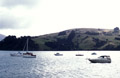
My last day in New Zealand. Though I was sorry to be leaving, I was also looking forward to going home again. The Akaroa Shuttle coach picked me up from the hostel at 9:30. The driver was quite friendly and chatty: named Bob, he currently owned a farm and drove coaches a few days a week, and was a former diesel engineer and had been involved in making farm machinery. There was only one other passenger: a woman from Singapore. The coach set off from Christchurch at 10am. We drove through Canterbury Plains for a while, before getting to Banks Peninsula. We stopped at Little River, where there was a coffee shop and quite a good art gallery/shop. Banks Peninsula was hilly but had very spectacular views, especially from the summit road, and would have made a very good bicycle trip for a less tired pair of legs than mine. In Akaroa, I went for a walk along the harbour, looked at various shops and galleries, and started on a walk out of town up hill. I decided not to go too far with the walk, partly because it looked like it was about to rain hard, and also because my legs were still feeling pretty stiff. Akaroa itself was a nice curved bay, nestling amongst the hills, with the shops, cafes and restaurants and other touristy bits around the edge of the bay, and the colonial houses and farms spreading out into the hills. I got the earlier coach back to Christchurch, at about 3:30pm, since I still had to pack for the flight next morning. The coach stopped at a cheese factory for a tasting on the way back: the matured cheddar was good, but I wasn't too impressed by the others. I finished packing at the hostel and decided to go out for lamb again for dinner, to compensate for not having eaten any earlier. Afterwards I met up with Andrew and George for a beer and to say my goodbyes. Then went to bed early, since the taxi to the airport would be picking my up at 4am next morning. Overall New Zealand was a wonderful country to visit, both because of the people as well as the land itself, and a great place for bicyling. I felt like I had only really scratched the surface on this trip, and there were still many places I wanted to see and things I wanted to see. I'm sure I'll be returning some time soon. |
|